M2.9 earthquake - 8.2 mi ESE from Port Townsend, WA
Status: Reviewed
71 Felt ReportsReport your experience
Magnitude2.9Time2025/09/16 01:29:30 AM UTCDepth33.72 miCoordinates48.072, -122.5967ID62189991
Origin
Statistics on estimate of an earthquake's location and time. For more info, see Earthquake Terminology.Orid
3352983Magnitude
2.94Time
1757986197.1999989Latitude
48.07200Longitude
-122.59667Depth
33.72 miLocation Quality
ExcellentEvent ID
62189991Event Type
eqGtype
lHorizontal Uncertainty
0.14 miDepth Uncertainty
0.21 miAzimuthal Gap
24 degNumber of Phases
136RMS Misfit
0.17Focal Mechanisms
Describes the fault orientation and slip direction of an earthquake and are generated using first motion (up or down) observations.Solution 1
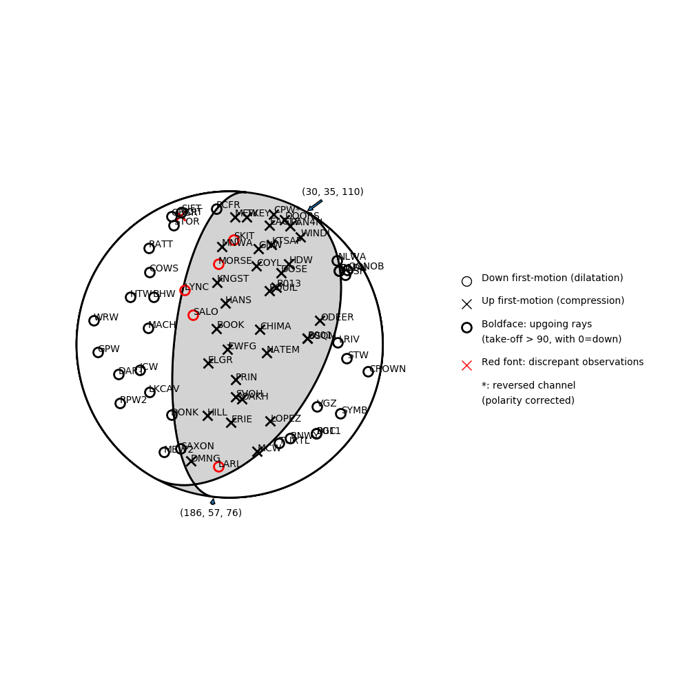
Number of P First motions: 71
| Plane A | Plane B | Uncertainty | |
|---|---|---|---|
| Strike | 30 | 186 | 25 |
| Dip | 35 | 57 | 15 |
| Rake | 110 | 76 | 25 |
Discrepant Stations
Stations whose observed first-motion does not match the predicted first-motion from the focal mechanism.| Station | Network | Channel | Polarity | Quality |
|---|---|---|---|---|
| LYNC | UW | HNZ | D | 0.9771 |
| SALO | UW | HHZ | D | 0.9771 |
| MORSE | UW | HHZ | D | 0.9243 |
| LARL | UW | HNZ | D | 0.9243 |
| VOIT | CC | BHZ | U | 0.9243 |
| SKIT | UW | HNZ | D | 0.9243 |