M1.8 earthquake - 6.71 mi NE from Tacoma, WA
Status: Reviewed
1 Felt ReportsReport your experience
Magnitude1.8Time2025/04/17 01:09:31 AM UTCDepth15.11 miCoordinates47.3133, -122.3445ID62093121
Origin
Statistics on estimate of an earthquake's location and time. For more info, see Earthquake Terminology.Orid
3319513Magnitude
1.78Time
1744852198.3599987Latitude
47.31333Longitude
-122.34450Depth
15.11 miLocation Quality
ExcellentEvent ID
62093121Event Type
eqGtype
lHorizontal Uncertainty
0.14 miDepth Uncertainty
0.22 miAzimuthal Gap
32 degNumber of Phases
97RMS Misfit
0.18Focal Mechanisms
Describes the fault orientation and slip direction of an earthquake and are generated using first motion (up or down) observations.Solution 1
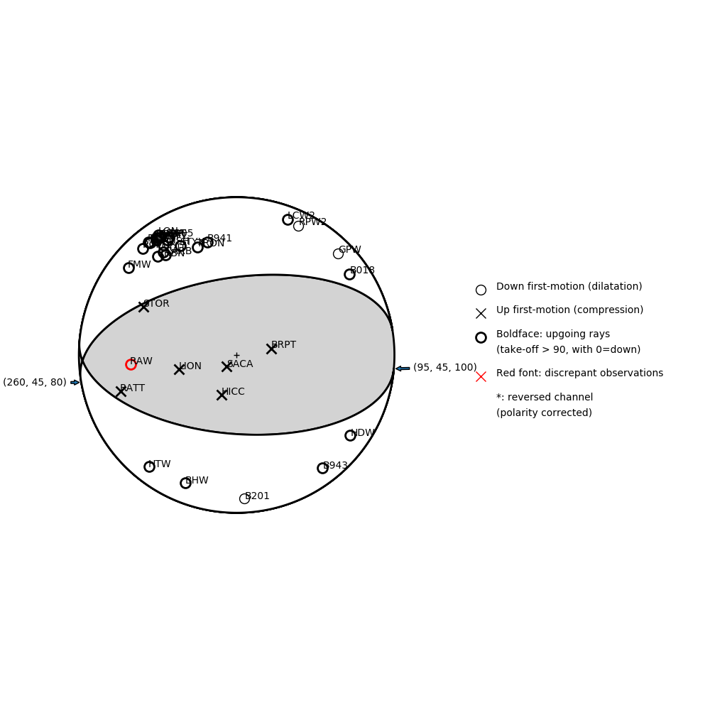
Number of P First motions: 34
| Plane A | Plane B | Uncertainty | |
|---|---|---|---|
| Strike | 95 | 260 | 53 |
| Dip | 45 | 45 | 28 |
| Rake | 100 | 80 | 40 |
Discrepant Stations
Stations whose observed first-motion does not match the predicted first-motion from the focal mechanism.| Station | Network | Channel | Polarity | Quality |
|---|---|---|---|---|
| RAW | UW | ENZ | D | 0.9243 |