M1.1 earthquake - 10.63 mi ENE from Tacoma, WA
Status: Reviewed
0 Felt ReportsReport your experience
Magnitude1.1Time2025/02/27 09:20:31 AM UTCDepth15.05 miCoordinates47.2978, -122.2255ID62078346
Origin
Statistics on estimate of an earthquake's location and time. For more info, see Earthquake Terminology.Orid
3311743Magnitude
1.14Time
1740648058.8999996Latitude
47.29783Longitude
-122.22550Depth
15.05 miLocation Quality
ExcellentEvent ID
62078346Event Type
eqGtype
lHorizontal Uncertainty
0.21 miDepth Uncertainty
0.34 miAzimuthal Gap
68 degNumber of Phases
50RMS Misfit
0.19Focal Mechanisms
Describes the fault orientation and slip direction of an earthquake and are generated using first motion (up or down) observations.Solution 1
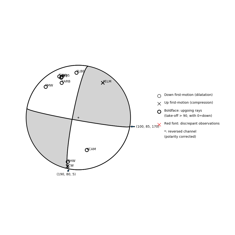
Number of P First motions: 10
| Plane A | Plane B | Uncertainty | |
|---|---|---|---|
| Strike | 100 | 190 | 23 |
| Dip | 85 | 80 | 63 |
| Rake | 170 | 5 | 45 |
Discrepant Stations
Stations whose observed first-motion does not match the predicted first-motion from the focal mechanism.| Station | Network | Channel | Polarity | Quality |
|---|---|---|---|---|
No items. | ||||