M2.1 earthquake - 8.33 mi SSW from Satsop, WA
Status: Reviewed
0 Felt ReportsReport your experience
Magnitude2.1Time2024/12/13 12:41:14 PM UTCDepth25.37 miCoordinates46.8828, -123.4978ID62059257
Origin
Statistics on estimate of an earthquake's location and time. For more info, see Earthquake Terminology.Orid
3302888Magnitude
2.11Time
1734093701.5999994Latitude
46.88283Longitude
-123.49783Depth
25.37 miLocation Quality
ExcellentEvent ID
62059257Event Type
eqGtype
lHorizontal Uncertainty
0.18 miDepth Uncertainty
0.27 miAzimuthal Gap
32 degNumber of Phases
108RMS Misfit
0.25Focal Mechanisms
Describes the fault orientation and slip direction of an earthquake and are generated using first motion (up or down) observations.Solution 1
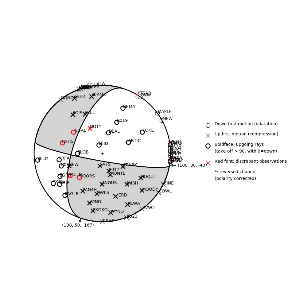
Number of P First motions: 69
| Plane A | Plane B | Uncertainty | |
|---|---|---|---|
| Strike | 100 | 198 | 15 |
| Dip | 80 | 50 | 23 |
| Rake | -40 | -167 | 25 |
Discrepant Stations
Stations whose observed first-motion does not match the predicted first-motion from the focal mechanism.| Station | Network | Channel | Polarity | Quality |
|---|---|---|---|---|
| DOTY | UW | HHZ | U | 0.9243 |
| DOORS | UW | HHZ | D | 0.9243 |
| INGAL | UW | HHZ | D | 0.9243 |
| MCLN | UW | HNZ | D | 0.9243 |
| RRHS | UW | EHZ | D | 0.9243 |
| PCFR | UW | ENZ | U | 0.9771 |
| KTSAP | UW | HHZ | U | 0.9243 |
| WOW | CC | BHZ | U | 0.9243 |
| ODUC | UW | HHZ | D | 0.9243 |