M2.9 earthquake - 8.95 mi NW from Hanford-200W, WA
Status: Reviewed
18 Felt ReportsReport your experience
Magnitude2.9Time2024/09/23 03:22:33 AM UTCDepth4.96 miCoordinates46.6087, -119.7968ID62049146
Origin
Statistics on estimate of an earthquake's location and time. For more info, see Earthquake Terminology.Orid
3290398Magnitude
2.94Time
1727061780.2599983Latitude
46.60867Longitude
-119.79683Depth
4.96 miLocation Quality
ExcellentEvent ID
62049146Event Type
eqGtype
lHorizontal Uncertainty
0.09 miDepth Uncertainty
0.06 miAzimuthal Gap
27 degNumber of Phases
52RMS Misfit
0.08Focal Mechanisms
Describes the fault orientation and slip direction of an earthquake and are generated using first motion (up or down) observations.Solution 1
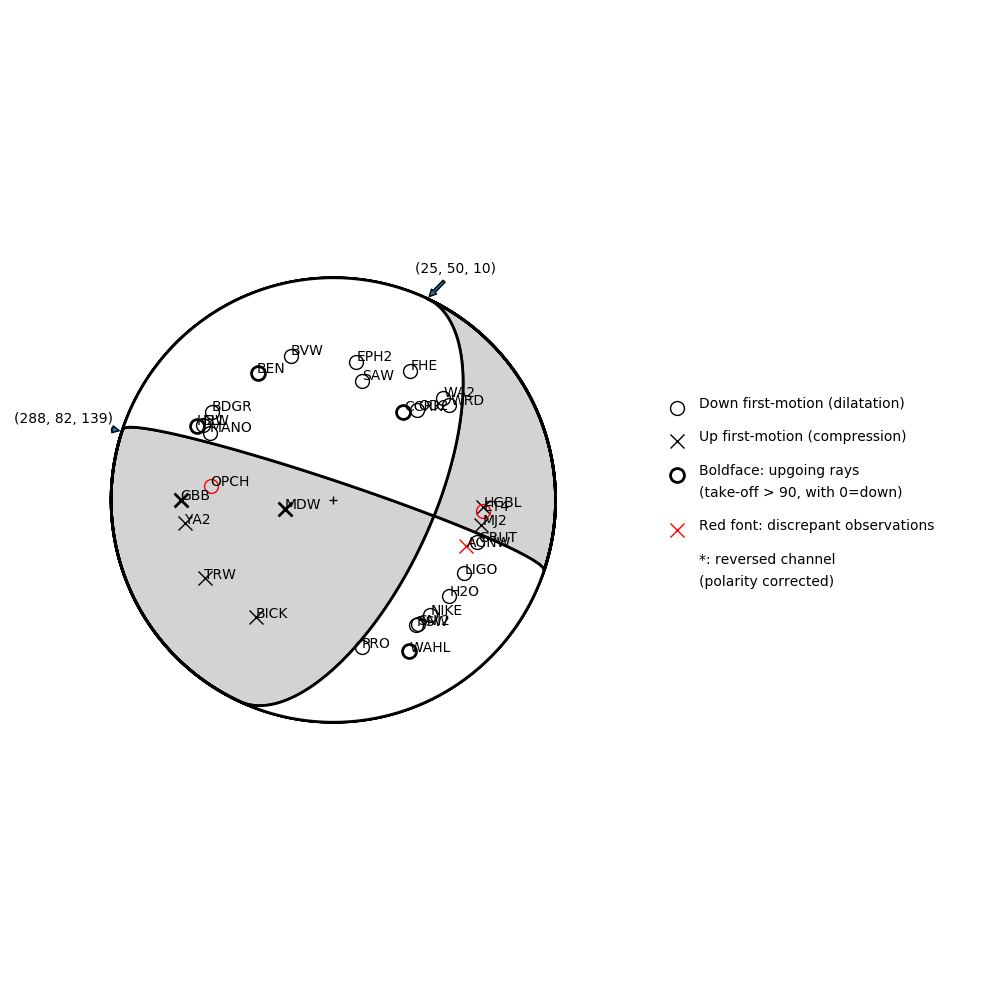
Number of P First motions: 31
| Plane A | Plane B | Uncertainty | |
|---|---|---|---|
| Strike | 25 | 288 | 20 |
| Dip | 50 | 82 | 20 |
| Rake | 10 | 139 | 30 |
Discrepant Stations
Stations whose observed first-motion does not match the predicted first-motion from the focal mechanism.| Station | Network | Channel | Polarity | Quality |
|---|---|---|---|---|
| ET4 | UW | EHZ | D | 0.9243 |
| AGNW | UW | HHZ | U | 0.9243 |
| OPCH | CC | BHZ | D | 0.9243 |