M2.0 earthquake - 19.39 mi S from Longview, WA
Status: Reviewed
0 Felt ReportsReport your experience
Magnitude2.0Time1970/01/02 05:00:41 PM UTCDepth12.94 miCoordinates45.8562, -122.9417ID62038321
Origin
Statistics on estimate of an earthquake's location and time. For more info, see Earthquake Terminology.Orid
3284843Magnitude
2.04Time
1724066582.8899994Latitude
45.85617Longitude
-122.94167Depth
12.94 miLocation Quality
ExcellentEvent ID
62038321Event Type
eqGtype
lHorizontal Uncertainty
0.09 miDepth Uncertainty
0.18 miAzimuthal Gap
22 degNumber of Phases
118RMS Misfit
0.16Focal Mechanisms
Describes the fault orientation and slip direction of an earthquake and are generated using first motion (up or down) observations.Solution 1
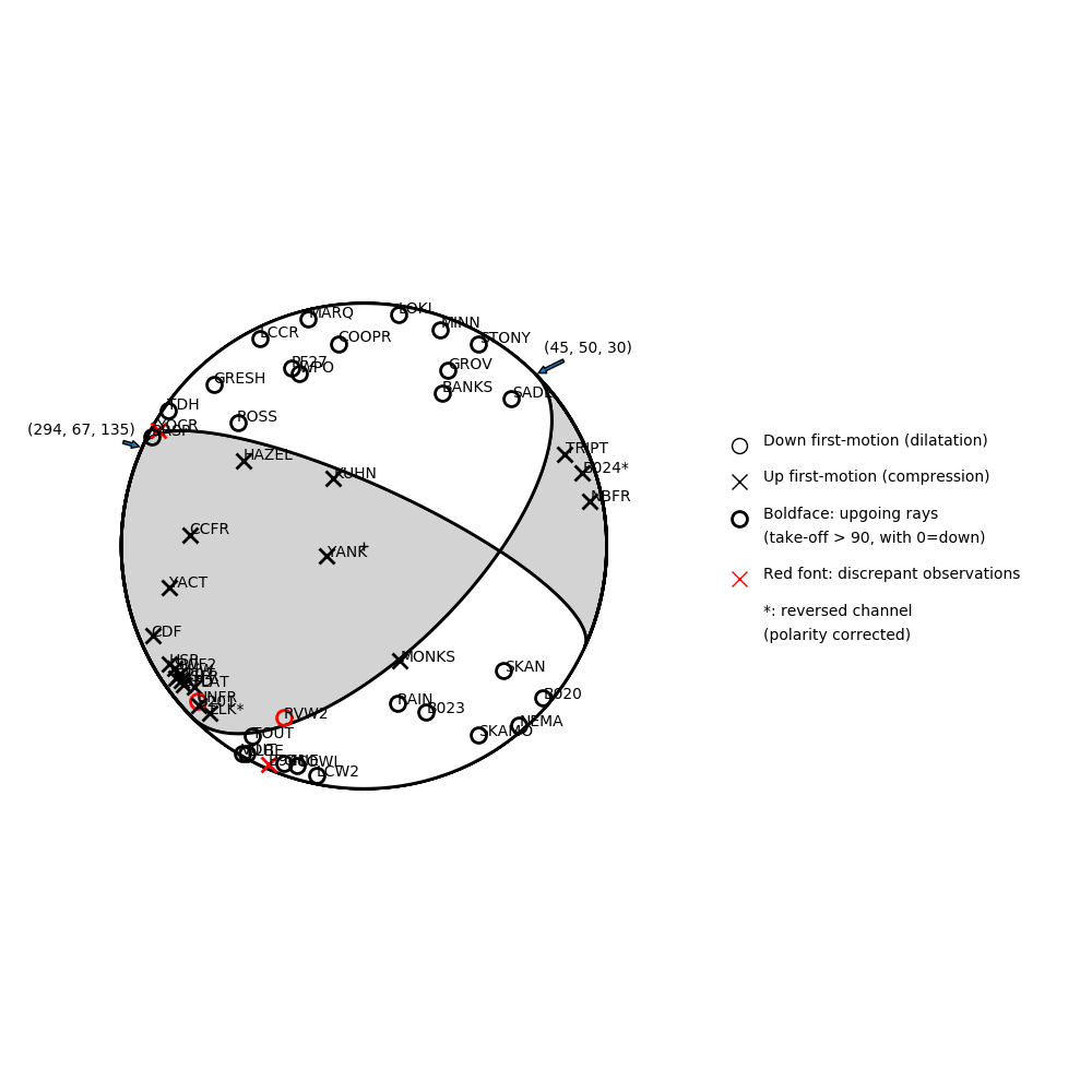
Number of P First motions: 50
| Plane A | Plane B | Uncertainty | |
|---|---|---|---|
| Strike | 45 | 294 | 18 |
| Dip | 50 | 67 | 30 |
| Rake | 30 | 135 | 35 |
Discrepant Stations
Stations whose observed first-motion does not match the predicted first-motion from the focal mechanism.| Station | Network | Channel | Polarity | Quality |
|---|---|---|---|---|
| RVW2 | UW | EHZ | D | 0.9243 |
| UNFR | CC | BHZ | D | 0.9243 |
| YOCR | CC | BHZ | U | 0.9243 |
| B941 | PB | EHZ | U | 0.9243 |
Solution 2
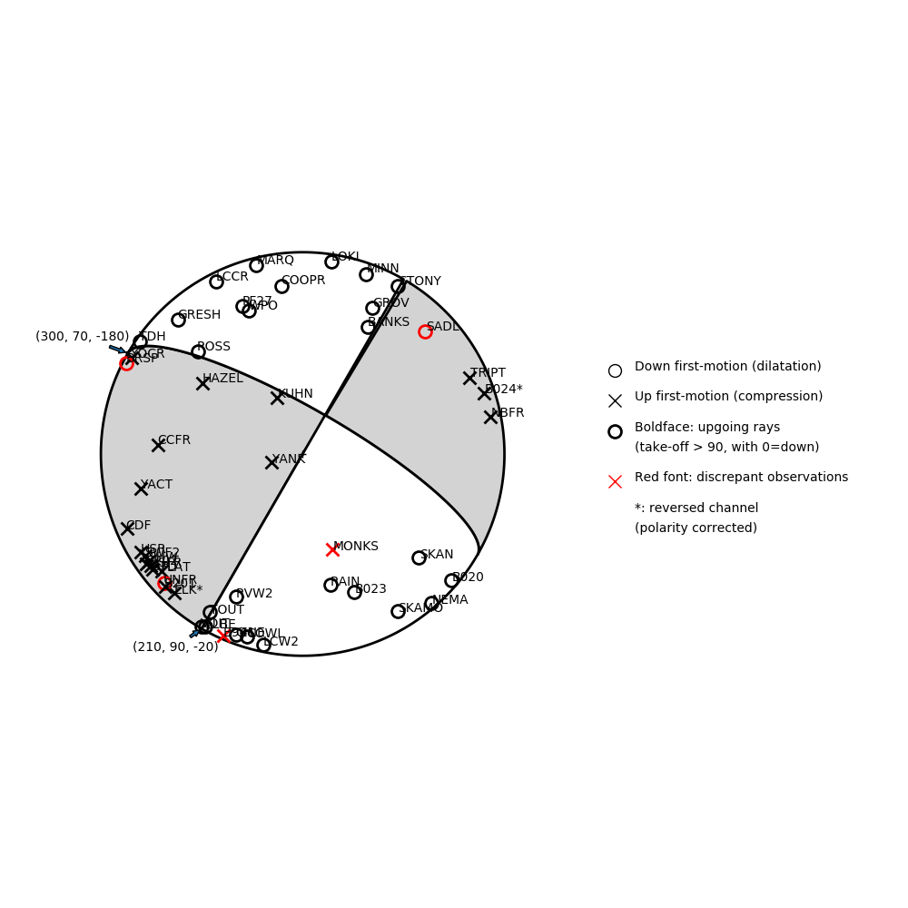
Number of P First motions: 50
| Plane A | Plane B | Uncertainty | |
|---|---|---|---|
| Strike | 300 | 210 | 15 |
| Dip | 70 | 90 | 35 |
| Rake | -180 | -20 | 20 |
Discrepant Stations
Stations whose observed first-motion does not match the predicted first-motion from the focal mechanism.| Station | Network | Channel | Polarity | Quality |
|---|---|---|---|---|
| MONKS | UO | HHZ | U | 0.9243 |
| SADL | UO | HHZ | D | 0.9243 |
| UNFR | CC | BHZ | D | 0.9243 |
| BRSP | CC | BHZ | D | 0.9243 |
| B941 | PB | EHZ | U | 0.9243 |