M2.9 earthquake - 14.04 mi SE from Centralia, WA
Status: Reviewed
35 Felt ReportsReport your experience
Magnitude2.9Time2024/04/02 09:20:39 PM UTCDepth15.09 miCoordinates46.6068, -122.7103ID61985927
Origin
Statistics on estimate of an earthquake's location and time. For more info, see Earthquake Terminology.Orid
3263863Magnitude
2.93Time
1712092866.8099976Latitude
46.60683Longitude
-122.71033Depth
15.09 miLocation Quality
ExcellentEvent ID
61985927Event Type
eqGtype
lHorizontal Uncertainty
0.07 miDepth Uncertainty
0.21 miAzimuthal Gap
16 degNumber of Phases
182RMS Misfit
0.16Focal Mechanisms
Describes the fault orientation and slip direction of an earthquake and are generated using first motion (up or down) observations.Solution 1
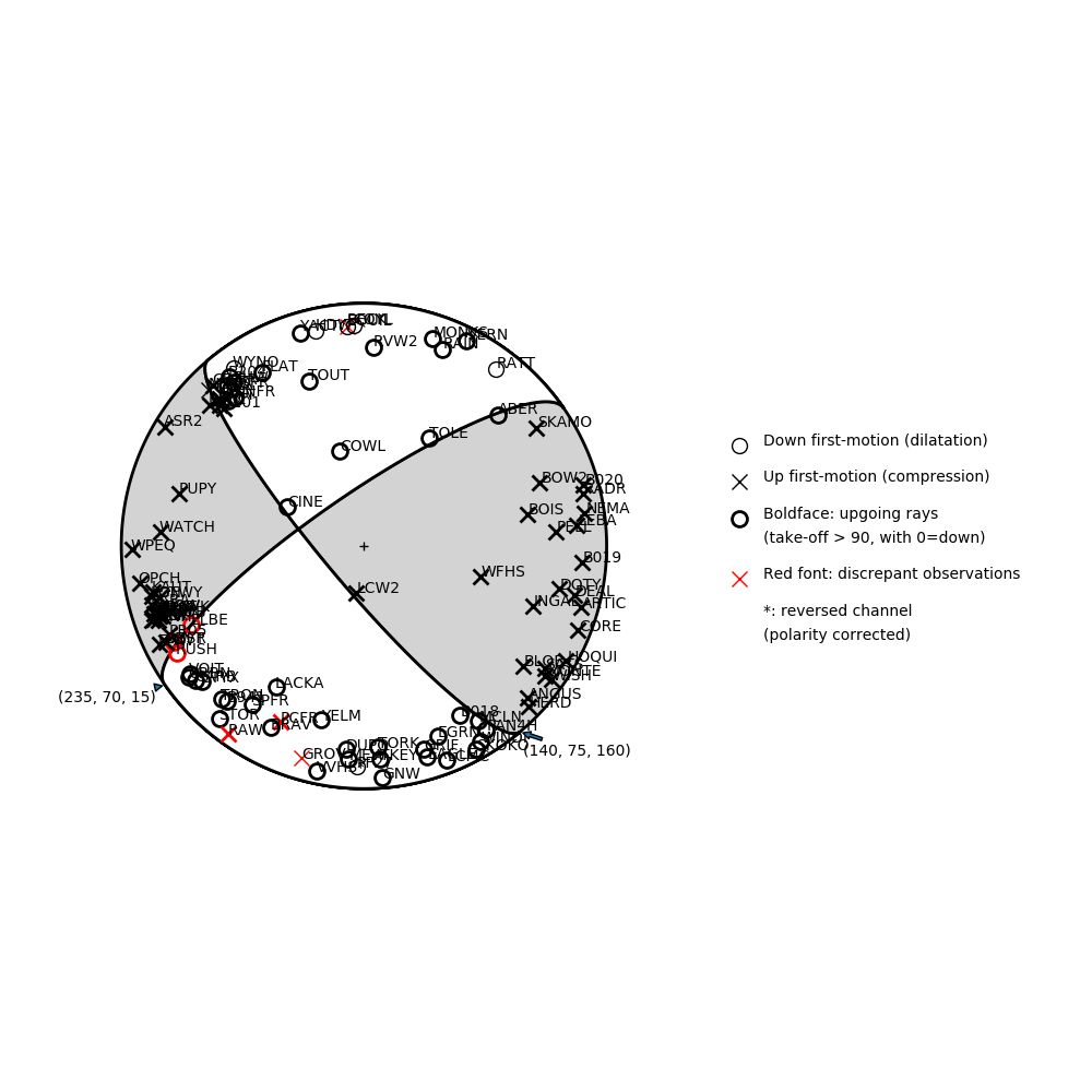
Number of P First motions: 108
| Plane A | Plane B | Uncertainty | |
|---|---|---|---|
| Strike | 140 | 235 | 5 |
| Dip | 75 | 70 | 20 |
| Rake | 160 | 15 | 25 |
Discrepant Stations
Stations whose observed first-motion does not match the predicted first-motion from the focal mechanism.| Station | Network | Channel | Polarity | Quality |
|---|---|---|---|---|
| ELBE | CC | BHZ | D | 0.9243 |
| PCFR | UW | EHZ | U | 0.9771 |
| SIFT | CC | BHZ | D | 0.9243 |
| RUSH | CC | BHZ | D | 0.9243 |
| RAW | UW | ENZ | U | 0.9243 |